
Mount Toubkal
North Africa's highest peak sits a ninety-minute drive from Marrakech, which makes a 4,167-metre summit weirdly weekend-able.
- Best forAdventure seekers · Walkers & hikers · Groups of friends
- In March15°C · 9 rainy days
- Ideal stay3–4 nights
- Approx. flying time~12h 10m from Los Angeles
- CurrencyMADMoroccan dirham
- LanguageArabic and French
- Local time10:191h behind the UK
- PlugsType C / EBring an adapter
- Drive on theRightOpposite to the UK
- Dialling code+212
Why go
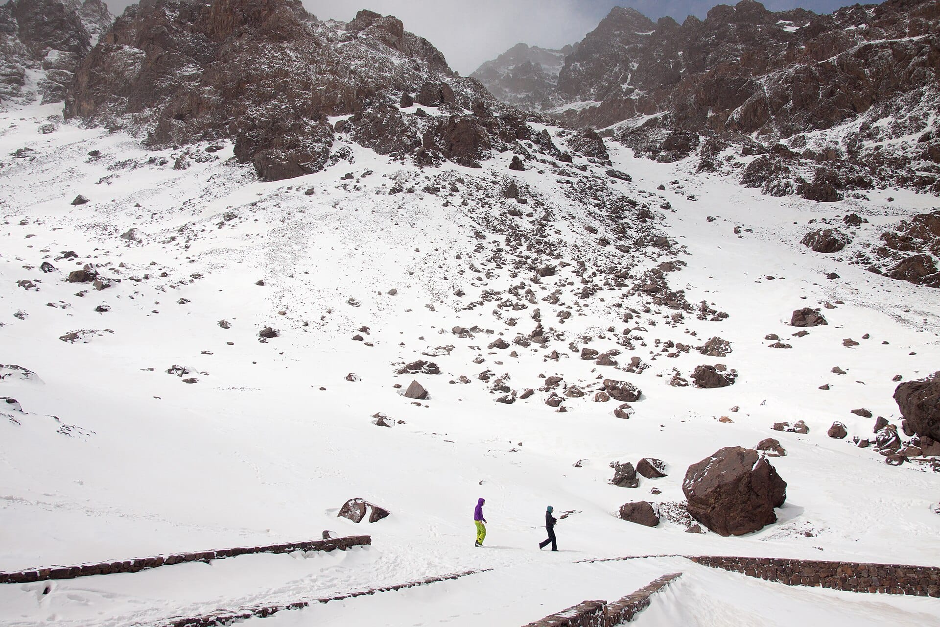
The trailhead village of Imlil sits among walnut trees and irrigation channels, with mules doing the heavy lifting and the High Atlas rising abruptly behind. Above it the greenery stops. What follows is a long valley of grey scree and boulder, a shrine at the halfway point, and a summit ridge where the whole range unfolds in dusty ridgelines towards the desert. It is hard walking rather than technical climbing.
Two days is the standard shape, which pairs neatly with three or four in Marrakech, ninety minutes away by road. Late spring through October gives dry rock and no ice axe; winter turns the same route into a mountaineering trip needing crampons and experience. Skip it if altitude bothers you, or if the idea of a shared bunkroom at 3,200 metres sounds worse than the climb.
- Ideal stay
- 3–4 nights
- The vibe
- Steep, dusty, quietly hospitable
From our guides
The standard two-day route climbs from Imlil to a mountain refuge, then tackles the scree to the top at dawn, with the Atlas rippling away towards the Sahara. Guides are mandatory and easily arranged in Imlil. Go May to October to avoid winter's ice; whatever the season, the mint tea back at the refuge is medicinal.
Featured in Ten treks for your first big summit or base camp
Things to do
-
Imlil and the mule tracks
The staging post for every ascent, where guides, porters and mules are arranged and the tarmac ends. Terraced orchards climb the valley sides above the village.
-
Sidi Chamharouch
A whitewashed boulder shrine roughly halfway up the approach, and a natural rest stop. Non-Muslims do not cross the bridge to the shrine itself.
-
The refuge at 3,200 metres
Two neighbouring huts sit below the final slope, serving tagine and endless mint tea. Everyone eats early and leaves in the dark.
-
Summit ridge views
From 4,167 metres the Atlas ripples away in every direction, with the Sahara's haze to the south. Clear mornings are the rule before the cloud builds.
-
Aroumd
A stone village stacked on a moraine above Imlil, reached in under an hour on foot. A good acclimatisation stroll on the afternoon you arrive.
-
The Ourika valley
An easy contrast on the drive back to Marrakech, with riverside cafés, waterfalls and Berber markets in the foothills.
Getting there
-
Fly to
Marrakesh (RAK)
Nearest airport to Mount Toubkal, about 55km away as the crow flies.
-
Then
To Imlil
About an hour and a half by taxi or transfer from Marrakesh (RAK), south into the High Atlas on a winding mountain road.
-
On the ground
Getting around
Imlil is the road head: from there it is on foot or by mule, about four to six hours up to the refuge, then the summit push at dawn. Guides are required and arranged in the village.
Public transport: Shared grands taxis run between Marrakech's Asni road and Imlil, but most trekkers book a private transfer with their guide.
Flights
Los Angeles Mount Toubkal, Morocco
Fly from anywhere — search 4,000+ airports worldwide.
Roughly 12h 10m in the air from Los Angeles (LAX), estimated from the distance — check for a direct route. Pick a month to see every available flight with live prices.
Check dates and prices
Pick your departure date, then your return.
Search flightsNot sure when? Compare fares across a whole month.
Flight times are estimates; prices open on Google Flights.
When to go
Daytime highs run from about 12°C in January to 30°C in July. Driest in July and August and December and January; wettest in April, with rain on about 10 days.
The year at a glance — pick a month for detail
March15° · rain 9 daysCool with rain most weeks.
Monthly figures averaged from daily records for 2015–2024 at Imlil (ERA5 reanalysis). Highlighted months are warm and mostly dry — June to September. Live conditions from MET Norway, CC BY 4.0.
Where to stay
Village gites and small trekking lodges in Imlil and the hamlets above it, plus two dormitory refuges on the mountain. No hotels of any size in the valley.
-
Best base overall
Imlil
The trailhead village where guides, mules and equipment hire are all arranged. Rooms are simple, the last stretch of road is rough, and everything shuts early.
Find stays in Imlil -
Closest to the sights
Toubkal refuges at Neltner
The two mountain huts at around 3,200 metres put the summit within a pre-dawn push. Dormitory bunks, basic meals and cold nights are the deal.
Find stays in Toubkal refuges at Neltner -
Quietest
Aroumd and Tamatert
Hamlets fifteen to thirty minutes from Imlil with guesthouses on the walnut terraces and better views. You walk down to the village for guides and supplies.
Find stays in Aroumd and Tamatert -
Best value
Marrakech
Ninety minutes away, with every kind of room and a comfortable night either side of the trek. It adds a transfer at each end and rules out an early first-day start.
Find stays in Marrakech
Worth knowing before you book: Refuge beds book out at weekends and through the summer, and a certified guide is now a legal requirement, so arrange both before you arrive.
Search everything else in Imlil by budget. These are indicative budget bands in GBP per night for two people, not live quotes or guarantees of hotel type. Check your dates, guests, taxes and final price on Booking.com.
Good to know
- Guides
- A qualified local guide is required for the ascent and is easily arranged in Imlil or Marrakech. Hiring a porter as well is normal and puts money into the valley.
- Timing
- May to October is the walking season. From November to April expect snow and ice on the upper slopes, which changes the trip entirely.
- Altitude
- You gain more than 2,000 metres in two days. Drink far more water than feels necessary and tell your guide early if your head starts pounding.
- Pack this
- Broken-in boots, a warm hat and a proper down or synthetic jacket. Summit dawn is well below freezing even after a hot day in Marrakech.
- Etiquette
- This is a conservative rural area, so cover shoulders and knees in the villages. A little French or Arabic goes a long way with mule handlers.
Similar places
Nearby destinations
Related articles
Quick answers
When is the best time to visit Mount Toubkal?
For warm, mostly dry days, June to September. That means highs of 20–34°C with rain on six days a month or fewer. Daytime highs run from about 12°C in January to 30°C in July. Driest in July and August and December and January; wettest in April, with rain on about 10 days.
How long should I spend in Mount Toubkal?
Our suggestion: 3–4 nights.
How do I get to Mount Toubkal?
About an hour and a half by taxi or transfer from Marrakesh (RAK), south into the High Atlas on a winding mountain road.
Do I need a car in Mount Toubkal?
No. Shared grands taxis run between Marrakech's Asni road and Imlil, but most trekkers book a private transfer with their guide.
What currency and language are used in Mount Toubkal?
Currency: Moroccan dirham (MAD). Language: Arabic and French. Plugs: type C and E.
Who is Mount Toubkal best for?
Best for adventure seekers, walkers & hikers and groups of friends. In a phrase: steep, dusty, quietly hospitable.